Headings

Food (552) History (446) Travel (261) art (233) maritimes (192) Spain (165) France (138) Vancouver Island (136) UK (96) Portugal (81) Postcard of the Interwebs (70) Musings (50) Tofino (47) Scandinavia (44) book (43) Italy (39) Hornby (31) Movie and TV (27) Music (24) Conventions (23) Newfoundland (19) Wisdom without Zealotry (17) Quadra Island (12) San Francisco (11) Ottawa (5)

Thursday, 16 August 2012

Nova Scotia - New France (1892-1912)

 
Driving down 22 km of paved road, 11 km of dirt road and 6.5 km of logging road (low riders beware) are the ruins of New France. It was a community established by the French aristocratic Stehelin family. They had some land cleared away, a mill built and houses (with sidewalks) constructed. There was also a small structure beside the mill that was able to generate electricity. At night it powered streetlights and gave the nickname to the community....Electric City. The local Mi'kmaq peoples thought it quite amazing and observed the community light up at night, especially as it was the only electricity 30 years before it was established elsewhere in the county.

The Stehelin family entertained people from all over and the community was a blend of French European, Mi'Kmaq, Acadien and Black peoples.

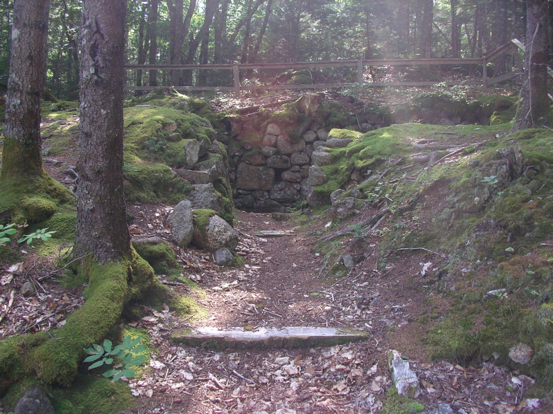
The picture above is the entrance. The trails are accessible to bicycles but much better on foot, as the ruins are overgrown on the sides of the roadway. It is not wheelchair accessible, unless you have an off-road one. There are picnic tables and overturned garbage cans in the grass parking lot near the entrance.
 This is the initial pathway and reflects the general state of the area. The main industry that was here, as it is now, is logging. One of the two main reasons it was abandoned was the desire for the male children to seek out life outside the community. The other, and most important one, was the sudden decrease in the price of logs. There was also a fire that burned a portion of the railway that was built by the family to ship logs to nearby Weymouth.
After the site was abandoned by the family, the buildings fell into disrepair and were looted and vandalized often. There were reports of spirits and ghosts in the area but this was mostly hearsay. In the 1950's, a paper company tore down all the structures. You can see some ruins here. It looked like there were actual signs (or at least posts to put up signs) here and there to describe buildings and sites of interest but there are not. We used a book written by Paul H Stehelim (although ours had a newer cover) as a guide, as there is a handy map inside.
 Here is the wine cellar. They were aristocratic after all.
 I like the solidity of the foundations at the same time as the raw power of nature.
 Another view of the wine cellar.
 Here is a view of the magnificent lake.
 Another lovely view. I can see why they picked this spot. The site was bought by Irving but now is owned by the province of Nova Scotia.

 This is the big house where the family slept. They had servants who were schooled in the European way of things.
 Another view of the big house.
 And another.
 These were some smaller buildings as seen from the road. As you can see it does take some careful looking to notice them if you aren't paying attention.
 The foundations of a large building.
 This is the river bed that would have housed the mill and powerhouse.


 An old bridge that is falling into disrepair. Please excuse the blurriness of the photo.
 Just after the bridge is a walking path that takes you near the casino would be. It was not a place of gambling but rather the classic use of the word as a place of relaxation. Here it was a beach house that also stored the sailboat and iceboat. If you don't want to take this nice meandering path, the roadway is just up the hill and on the right.
 A picture taken on the pathway.
 This is the sand on the beach. Very coarse and contains lots of quartz.
 This is a view on the beach towards where the New France community would be. A person canoing on the lake would never know it today.
 Somewhere around here would be the casino. It is used as a campsite but is quite messy with some garbage and camp stove propane tanks here and there. Hopefully the province tidies up the site and places sign-age on the bare poles that were made for them.
 Another view of the lake. I like the tall trees on the island. Its just begging to be rowed out to.
This is the pathway on the way back from the beach. There were frogs that jumped in the various pools as we were walking out.

All in all an interesting and forgotten area in Nova Scotia history. An interesting site with pictures of the structures as they were is here.

UPDATE: I received an email from Harold Carroll, the Nova Scotia Department of Natural Resources Director of Parks and Recreation:

"Thank you for the information. When the province acquired the lands in question it did so as a means to protect the heritage aspect with the understanding that no resources were available to provide any maintenance and or improvements to the site.  Local people are from time to time removing some of the garbage on a volunteer basis and we greatly appreciate that help. Interpretive signs did exist but were removed by the previous landowner as they were their property and not suitable for posting under a new landowner.
There are no plans for the area at this time."
 
Its unfortunate that the signs that were there by Irving could not be kept, with stickers on top of the Irving signs. I'll try to see if they can donate them back.

UPDATE 2: I emailed Irving the above email and its been forwarded to the VP of Communications. Here's hoping for signage!

UPDATE 3: I was contacted by Annapolis Valley Vacations to put something up on their site. Here it is. Check it out if you are in the area for places to go and things to do in this area of Nova Scotia.

Wednesday, 15 August 2012

Annapolis Tidal Power

This facility was built in 1984 to harness the power of the severe tides that occur four times a day in the Bay of Fundy. The power plant has the most stories of any building in Annapolis Royal but nine of them are below ground because they house the turbine. It generates 80-100 Megawatts a day but more were not built after this one in the same design. That's because the act of dumping a lot of earth to block a river to store water to make electricity harms the environment more than you would think. The banks nearby have eroded, the passage of fish is no longer as free as it was and two whales got caught in behind the dam and one died. Even Nova Scotia Power is looking to other ways to generate power using the tides that don't harm the environment.

I went here shortly after it opened and even though it wasn't the best of outcomes, it is a step towards developing renewable energy.

Nova Scotia - Port Royal

Port-Royal was the name given to the French colony founded in 1605, near Annapolis Royal in Nova Scotia, Canada. The male colonists traded furs with the Mi'kmaq peoples. It was inhabited until the British raided and burned it down when the colonists happened to be away. The colonists spent the winter with the Mi'kmaq until a French ship picked them up the next year. It was never reestablished in the same spot but relocated to where Annapolis Royal stands today. Click here for my post on Fort Anne, the British name for the French Fort in Annapolis Royal once they took it over. The picture of the fort was drawn by Samuel de Champlain in 1612.
This fort is not the original structure. It was built by local shipbuilders and is a fantastic structure that, though built 1939-1941, will last for generations more.
The front of the structure is simple, impressive and effective. Although, as mentioned before, not if you don't leave anyone behind. The only entrance is seen in the picture above.
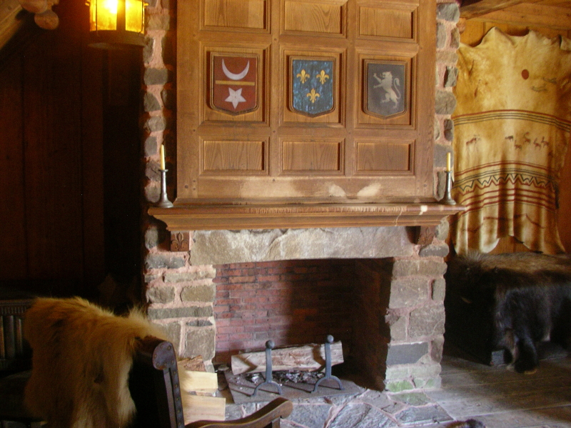
These crests are in two places on the site. The top one is the crest of the King of France. I assume one of the other two represent the noble who founded this trading post, Pierre Du Gua de Mont. I don't know what the other one could be.

Another interesting person on the trip was Mathieu da Costa, the first registered black man in North America; although his presence in Port -Royal has been in dispute. He was a multi-lingual explorer much in demand by the French and Dutch.

Here is the trading area. Mi'kmaq would enter into the fort and come into this room, the first on the right hand side. They would exchange their furs for manufactured goods, many examples of which are behind the "till".
Here is an actual beaver pelt. It was incredibly soft.
This is the view once you enter the fort, looking to the left. The first room is the administration room.
This is the center area.
This view is straight ahead. Just to the right is an open fortified area with a raised area for looking or shooting over. The French colonists had an extremely friendly relations with the Mi'kmaq peoples because they respected their territory and independence. They helped the French in their many wars with the British.
This is the room beside the trading room, connected by a door, and used to store the furs, goods and contains a cellar to keep goods cold that need to be.
This would have been de Mont's room where the second example of the crests are. He would have conducted business and relaxed here and slept upstairs.
There are a series of rooms with double bunks, a fireplace, desk and dressers. They would have been for senior members of the port.
Here is the apothecary's bedroom and place of work.
Here is the chapel. Mi'kmaq Grand Chief Membertou converted to Catholicism in 1610. He also made an agreement with the Jesuit priests who baptized him that his peoples could choose Catholicism or Mi'kmaq traditions. This helped to cement relations between the French and Mi'kmaq peoples.
Here is a machine that makes shapes in wood with a leather strap moving back and forth over the wood at relatively high speed. Pretty cool. Would also help keep you busy during the long winters.
Here are the common barracks with lots of bunk beds.
It also provides a convenient hole to shoot through and give air circulation.
Here is the main dining area. It is also the place where the order of good cheer was founded to combat "land sickness" or what we now know as scurvy, by de Champlain. It was done from the Fall until March weekly and was a combination of theater and food...dinner theater! It has been reestablished and you must be invited by an existing member.
Here is a raised area off of the dining room. It has many small cannon.
Here I am aiming it at potential foes.
This is the view of the other area of the fort and the front entrance.
The bakery.
 The kitchen prep area.
 The kitchen cooking area of the same room.
 The windows use animal skin or vellum. Very romantic but effective.
 The blacksmith's room.
If you're in the area of Annapolis Royal and/or Digby, visit Port-Royal. Here is the Parks Canada website.

Monday, 13 August 2012

Digby Scallops

 Scallops. They are the main item caught by Digby boats and the raison-d'etre for the Digby Scallop days previously mentioned.
 This retired fisherman was showing people how to shuck a scallop and offering it to people to eat. Raw.

They were delicious. Tasted sweet and slightly salty and wasn't slimly. As the fellow said, people that can't eat a lot of scallops due to their taste can generally eat more of them raw. After having one, I remembered that I have had one as sushi, but this was definitely fresher.
Scallops can also be breaded and fried, flash fried, used in stews...the list is endless. If you do get scallops in your local store, get them fresh or dry-packed. Wet-packed ones are treated with sodium tripolyphosphate to make them absorb more water and therefore weight more. Ick.